|
Software & Projects
|


 |
Software designed and written for research
should be as robust as business software. I believe software must be
designed to be easy to use, multi-platform and readily extendable to
incorporate new ideas. Code should be written in such a way to be
easily shared and understood by others. Some of the software
I have written is shown below:
|
|
|
- Sloazvis (2005 ― 2008) [Details
and pictures...]
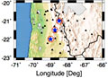
I was part-funded (10%) on a 3 year NERC project ("Imaging Slabs in the
mid- and lower-mantle") to help with data analysis and visualisation.
The tool that evolved from this project has also been used to visualise
Earth's magnetic field. The software development was based on the
concepts used to render the results of MRI scans. 2D slices of data are
added together to form a 3D block. The tool assigns varying levels of
opacity using values at each node and constructs hundreds of planes
perpendicular to the viewer that slice at an arbitrary angle through
the data. This creates volume rendering which allows the user to 'see
into' the data. The tool also creates movies by sampling a series of
parallel 2D slices thru the data.
|
|
|
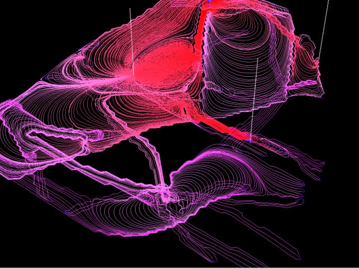
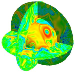
- MantleVis (2001 ― 2002) [Details and pictures...]
One of the major research projects based on the NESSC
supercomputer used the TERRA
code to model convection in Earth's mantle. The modelling produces very
large amounts of data - in excess of 100 million data points.
Visualisation on this scale was not practical using existing software
systems. MantleVis parallelises the problem over very many
server processes which each render a partial image; the client part
collates the sub-images over a network and visualises the total
picture. Complex surfaces and cross-sections can be generated within
seconds and minutes: the fully assembled picture can be rotated and
zoomed in real-time.
|
 |
|
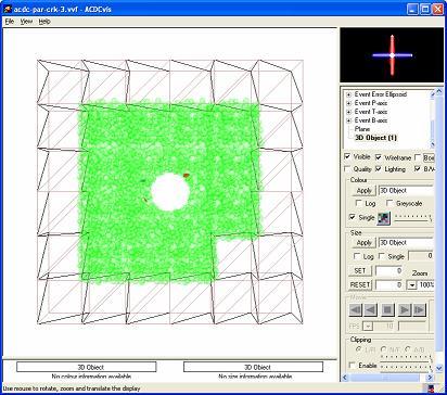
- ACDCvis (2001 ― 2004) [Details
and pictures...]
The major objective of SAFETI
(a 3 year EU-funded project) was to develop and test a new innovative
3D numerical modelling procedure (AC/DC) to enable the simulation of
nuclear waste repositories in rock. ACDCvis was developed as
part of SAFETI: it was funded as one of the project's work packages. It
is a graphics application that visualises observed and modelled
datasets. The aim of ACDCvis is to provide a way of bringing
together these two classes of data - the data exist in the time
dimension in addition to being positioned in 3D space.
|
 |
|
- MESS (2001 ― 2003) [Details and pictures...]
In heterogeneous sub-surface environments, the interpretation
of Ground Penetrating Radar (GPR) sections is complicated by the
influence of near-field effects, antenna radiation patterns, velocity
variations and surveying inconsistencies. MESS is an implementation of a Finite-Difference
Time-Domain (FDTD) mathematical model used to aid traditional section
interpretation. A single-processor implementation of this FDTD requires
extremely long run times: MESS is a MPI-based parallel code
designed to run on a Beowulf Cluster or multiple networked Windows PCs.
|
 |
|
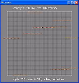
- Cracker (2001 ― 2002) [Details
and pictures...]
Cracker numerically
simulates the growth and interaction of Mode I fractures in
2-dimensions by implementing Linear Elastic Fracture Mechanics theory
(LEFM). Accurate simulation
of these fracture systems can help provide geometrical templates for
incorporation into fracture flow models and therefore may be of
economic benefit when predicting the porosity of some hydrocarbon
reservoirs. This work was carried in partnership with Dr Chris Bonson
of the Fault
Analysis Group and and built on descriptions of fracture systems
collected during the EU-funded project Equivalent
volume modelling of dual porosity dual permeability hydrocarbon
reservoirs.
|
 |
|
- FaMOUS (1992 ― 1998) [Details and pictures...]
FaMOUS (Fault Modelling Of Uneven Surfaces) was a product of a 3
year project funded by (the now renamed) Petroleum Sciences Technology
Institute (PSTI). The original research software built cellular models
from imported stratigraphic surfaces and used algorithms to include
sub-seismic faulting by geometrically distorting the 3D model. When the
project ended in 1995, PSTI were very keen to see FaMOUS
commercialised. I managed a small team seconded from partner Oilfield
Systems Ltd which successfully created a commercial version of the
software based on a series of libraries which greatly extended the
research functionality. Unfortunately work had to be abandoned before
Oilfield Systems Ltd went into voluntary liquidation in early 1999.
|
 |
|