

|
|
|
|
FaMOUS |
|
|
|
FaMOUS was a geological model building system designed to incorporate faulting at the very beginning of the modelling process. Fault surface geometry could be defined in two ways: 3D fault 'sticks' imported from a seismic interpretation package (e.g. Landmark™) were combined and contoured to form 3D gridded surfaces or fault polygons were imported from geological maps and combined between maps to form the 3D fault surface. |
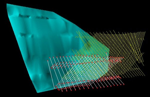 This picture shows correlated fault sticks (white and red) about to be gridded; uncorrelated fault sticks (yellow) and a fault surface formed by combining 6 fault polygons in 3D space. Once created, the fault surfaces were stored in a database for later use. |
|
|
Geological surfaces marking the 'tops' of major rock sequences were imported from mapping packages and combined with the fault surfaces to form a 'solid' 3D model bounded on all sides. Major tops were originally created within seismic interpretation software and other surfaces lying between these were picked using stratigraphic principles within a well correlation package. |
|
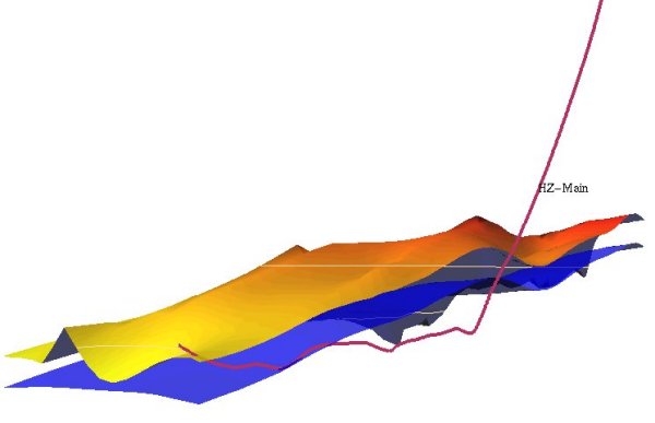
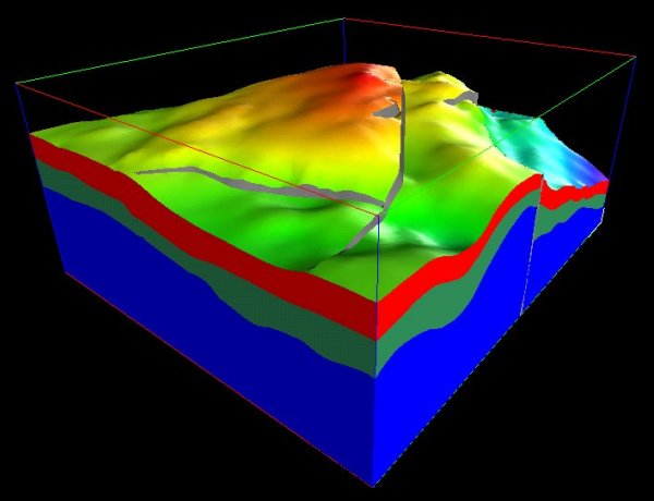 Solid model geometry formed by combination of fault and other surfaces. The upper-most surface is coloured by elevation (red represents shallowest). Grey surfaces represent the faults: note the complex cross-cutting of two faults at the centre of the model. The faults shown here are steeply dipping but not vertical: displacement varies naturally along the strike of the faults. |
|
|
The output from FaMOUS was a celluralised model which captured the complex geometry created when faults are properly included as part of the model structure. The cellular model was intended as input to a flow simulator such as Eclipse™. FaMOUS generated cellular layers within the geometry of the model and used information derived from well logs to aid population of the cells with properties required by a flow simulator. |
|
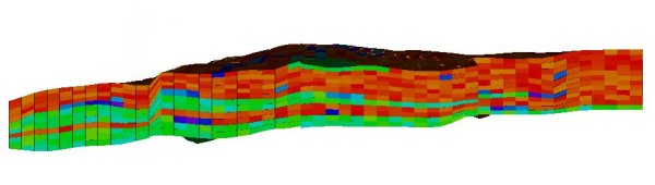 Cross-section of property values distributed throughout the FaMOUS cellular model. |
|
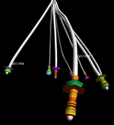 Wells penetrating a model showing well log values: the grey pipes show the path of the well bore and the coloured disks show a log property (gamma ray) varying with depth - blue represents a high value. |
|
  |
|
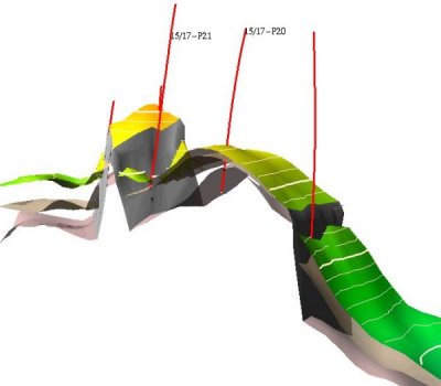
|
The pictures above show the interaction of wells and surfaces possible with FaMOUS. The left picture shows multiple, faulted surfaces contoured and penetrated by wells. The right hand picture shows a horizontal well drilled through a sequence and then directed back into the sequence. |