|
|
|
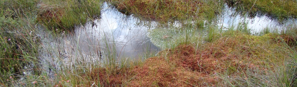
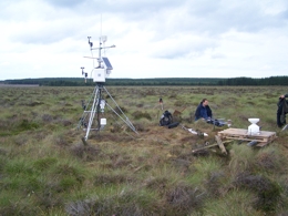
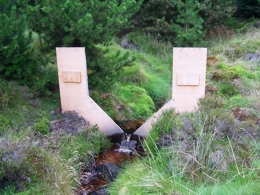
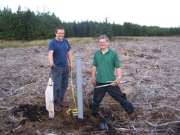
May Moss SSSI May Moss is a blanket mire, located on the watershed between Eller Beck and the River Derwent headwaters (Fig 1), and because it draws water solely from rainfall it is an ombrotrophic peatland. It is the largest single area of blanket bog on the North York Moors (representing 8.9% of this resource) and supports a plant community scarce in eastern Britain. The blanket mire comprises two basins with deep (>5m) peat deposits centred on the headwaters of Eller Beck and the southwards draining Long Grain. Much of the Long Grain basin is currently covered by plantation (Pinus contorta) forestry. The western section at the head of the Eller Beck is 71Ha, has long been protected with SSSI status, and now forms part of the North York Moors SSSI/SPA. The eastern section draining into the Derwent catchment via Grain Beck was afforested between 1975 and 1983. The project area is owned and managed by the Forestry Commission, the UK government forestry agency. Fylingdales MoD station and Forest Commission fencing have protected the site from grazing and human access since the 1960’s, thus the bog is largely in a rare intact virgin condition. The surface wetness of May Moss is a delicate balance between precipitation, evapo-transpiration and surface run-off, and thus affected by the climatic regime and land use practices on and adjacent to the peat land. Typically for an ombrotrophic mire the bog water table is close (0-30 cm) to the surface throughout the year producing the near saturated conditions that maintain the surface stratification that forms the contact between aerobic (acrotelm) and anaerobic (catotelm) peat. The depth of the acrotelm/catotelm boundary corresponds with the summer water table and reflects the maximum depth of peat exposed to oxygenated conditions. The acrotelm/catotelm structure is integral to the process of mire development, because the decline in decay of organic matter across the contact encourages the growth of peat sequences. Afforested peat lands typically have lower water tables due to the cutting of drainage ditches to assist tree growth and the greater evapotranspiration of coniferous forest compare to blanket moor. The surface drying experienced by May Moss in the last few decades is in part due to some of the warmest years on record in the last 10 years. The drying trend is evidenced from two sources surveys of the vegetation across May Moss were undertaken in 1976, recording the vegetation along three 1 km transect lines (Atherden, unpublished) and again repeated in 1996 and 1998. Increased occurrence of Eriophorum spp., Erica tetralix, Erica cinera and Sphagnum species on the watershed of the mire testify to drier conditions. Chiverrell (1998; 1999; 2001) identified drier conditions in the surface layers in detailed stratigraphical investigations of the peat deposits. Testate amoebae (Protozoa) and plant macrofossil stratigraphies show this drying trend at four different locations across the mire. The causes of this drying are difficult to discern with extension and expansion of the forests flanking the site in the 1970’s and 1980’s undoubtedly contributing. Forest Enterprise has design plans for Langdale Forest, which have involved removing conifers on the western approaches to May Moss. Future plans focus on the removal of conifers from the southern and eastern tracts of May Moss, a strategy that will help to conserve and expand this blanket mire. Removal of forest from the eastern sector will expand the area of blanket mire with deep peat, because the forestry is located over a second peat basin. Returning May Moss to a state in which peat accumulation on both the Long Grain and Eller Beck headwaters are unaffected by forestry should improve the hydrological status and increase surface wetness. Reduced efficiency of evapotranspiration and surface drainage may off-set the component of surface drying driven by climatic conditions. |
    |