Cautious Hopes For The Orinoco
By Jorge Sole in Venezuela *
"Never
have I read nor heard say that such great amounts of fresh water
could be found in this manner inside, and together with, salt
water...and I declare that if this river does not come from Paradise
itself, it surely must then come from an infinite land,". Thus wrote
Christopher Columbus in his diary when he found the Orinoco delta on
the first day of August 1498.
The oldest geological formation in South America is the Guiana
Shield, in the north east of the continent. Its western waters flow
into the Atlantic Ocean, forming what we know as the Orinoco River.
The river basin drains nearly 1m sq km. The right bank basin of the
river, entirely Venezuelan, is formed by the Guiana Shield, covered
by flat-top mountains called Tepuys and tropical rainforest.
 |
|
©WWF-Pambour
Orinoco
|
|
From its sources on the
Venezuelan-Brazilian border in the Parima Mountains, the Orinoco
flows for its first 600 km west-north-west through virgin jungle.
From the south it receives the black waters of the Atabapo River and
bends sharply north for the next 500 km, with the same tropical
jungle on the right bank and the huge llanos (savannahs) on the left
bank.
Crossing these llanos and descending from the Colombian Andes,
the Guaviare and the Meta rivers make a massive contribution of
water and sediments. The Apure, also a left-bank tributary, collects
waters from Venezuelan Andes and after these confluences, the
Orinoco bends again, to flow eastwards for 800 km towards its delta.
Every second it throws 2m tons of freshwater into the Atlantic, the
volume of its discharge the fourth largest in the world.
The Orinoco presents one of the few natural inter-basin
connections. After descending from 1,047 metres above sea level at
its sources to 100 metres over the first 400 km, the river loses
20-25 per cent of its water through the Brazo Casiquiare, which,
flowing from its left bank, joins the Amazon basin.
It was the first river in America to be discovered by Columbus
and the last to disclose its sources to Western civilization. Only
after 453 years, in 1951, was white man able to cover the 2,150 km
of its partly impenetrable course. The tropical climate, mosquitoes,
malaria and innumerable rapids and waterfalls, together with the
Yanomamis' fearsome reputation as brave warriors, protected the
right bank of the basin from conquerors and colonizers.
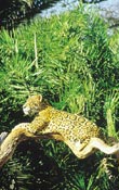
Large crocodiles and turtles, dolphins and manatees shared the
river with the nativeIndians, and can still be found today. Even
after 500 years of poorly planned development, the river is still
powerful and healthy. Spaniards struggled with the English and the
Dutch, following the El Dorado legend, but no gold was found, and
the Capitania-General de Venezuela, covering the entire basin, was
one of the poorest of the Spanish colonies.
|
 |
|
©WWF-Gunther Jaguar,
Orinoco |
On the left-bank llanos,
which flood annually, cattle were raised and flamingo feathers were
collected and sold to Europe. In 1917, oil was discovered in
Venezuela, and during the Second World War the basin was explored
for raw materials. Gold, iron, bauxite, diamonds, quartz, kaolin,
silica, coal and natural rubber were found in large quantities,
apart from 250,000 sq km of forest. But it was petroleum that
fuelled the legions of developing companies and engineers arriving
from Europe and North America to design and build the new modern
country.
On the right bank basin, the Caroni River which collects almost
all the waters from the Gran Sabana (a savannah at the top of the
Guiana Shield) was locked to form the great Lake Guri, providing
huge amounts of energy for the whole country and for the steel and
aluminium industries, both built in the newly founded city of Ciudad
Guayana, at the confluence of the Orinoco and the Caroni. Almost all
the tributaries of the Apure River were locked, for reasons of water
management or hydroelectric power.
Engineers followed the newest technological trends. As a result,
the hydrology of all the tributaries from the Andes in the west that
cross the llanos has changed dramatically, and the flow of these
rivers has been reduced by as much as 30 per cent. Herbicides,
pesticides and fertilizers drain into the rivers, lowering the water
quality. Dams and overfishing interfere with biological cycles,
exhausting and modifying fisheries. The main course of the lower
Orinoco has been dredged, and one of the arms of the delta (the Caño
Manamo) has been closed with the intention of controlling floods,
generating farmland and increasing water flow into the main arm to
facilitate the passage of transatlantic ships, which export iron
ore, steel, aluminium and alumina from Ciudad Guayana.
* The author travelled almost the
whole length of the Orinoco while making a film on the river for
Deutsche Welle and Sudwestfunk of Germany.
Next
>